We woke up early the next day to a cold morning. We quickly packed
up our tent and gear and headed up the trail. You want to get
an early start so you can get up and over the passes before any
afternoon storms develop. (All week long we were getting up early
every morning! . . . . some vacation!) We soon came to the second
crossing of West Maroon Creek. The cold air over night had all
the wet rocks in the stream coated with a thin film of wet ice
making them very dangerous. We had to step on the submerged rocks
that were only wet and not iced.
|
|
Continuing up the trail we started to see what was ahead of us, a tall
solid wall of a mountain ridge. I'm wondering; "Where's the pass?
A pass is supposed to be a low spot along the ridge!". As we get
closer to the ridge the trail gets steeper and the altitude increases.
Coming from sea level along the east coast just 2 days ago, I'm not prepared
for the thinner air at altitude. I'm slowing down and panting more. Fortunately,
Diane is having an easier time of it.
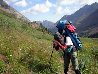
I assume this position a lot as we continue the
climb up to West Maroon Pass. The altitude is getting to this
sea-level dweller.
|
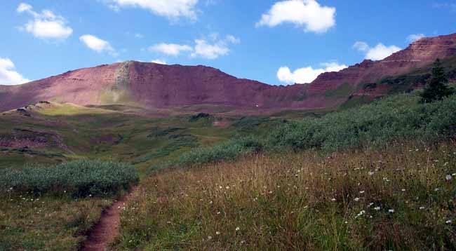
West Maroon Pass is just up ahead. It's the low spot to the
right of center.
|
Eventually we make it to the pass! The views out both sides of the pass
are fantastic and well worth all the effort! The photos below show the
fabulous views from West Maroon Pass.
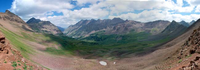
This is the view from the pass back down West Maroon valley
towards Crater Lake.
|
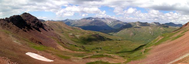
This is the view beyond the pass. We drop down into this valley
and follow
the right side slope till we get to Frigid Air Pass.
|
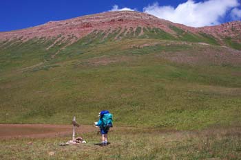 Unfortunately,
we still have to make it over Frigid Air Pass today. After a short rest
and snack, we head down the backside of West Maroon Pass and traverse
the valley over to Frigid Air Pass. Soon I see what appears to be the
pass up ahead. But before we get there, we come to a trail junction at
a small pond. (See photo to the right). The sign tells me that the low
easy pass I see up ahead is for Hasely Basin, Frigid Air Pass is 1/10
of a mile straight up the hill to our right! :-( I'm totally
devastated! How am I ever gonna make it up this short steep climb? I drop
down into my lowest gear and just start trudging up the trail. I trudge
along for 20 feet, then stop and pant. I keep repeating this process till
we eventually make it to the top!! Again, the views are fabulous, well
worth the effort to get there. I look down into Fravert Basin. The tree
line is about another mile down in the valley. All we have to do
is get down into the woods and look for a good campsite. Fortunately
the trail was a nice gentle slope down from the pass. Note my frequent
use of the word down. My legs and lungs needed it. The photo below
shows the view from Frigid Air Pass down into Fravert Basin. Unfortunately,
we still have to make it over Frigid Air Pass today. After a short rest
and snack, we head down the backside of West Maroon Pass and traverse
the valley over to Frigid Air Pass. Soon I see what appears to be the
pass up ahead. But before we get there, we come to a trail junction at
a small pond. (See photo to the right). The sign tells me that the low
easy pass I see up ahead is for Hasely Basin, Frigid Air Pass is 1/10
of a mile straight up the hill to our right! :-( I'm totally
devastated! How am I ever gonna make it up this short steep climb? I drop
down into my lowest gear and just start trudging up the trail. I trudge
along for 20 feet, then stop and pant. I keep repeating this process till
we eventually make it to the top!! Again, the views are fabulous, well
worth the effort to get there. I look down into Fravert Basin. The tree
line is about another mile down in the valley. All we have to do
is get down into the woods and look for a good campsite. Fortunately
the trail was a nice gentle slope down from the pass. Note my frequent
use of the word down. My legs and lungs needed it. The photo below
shows the view from Frigid Air Pass down into Fravert Basin.
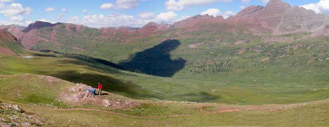
This is the view from Frigid Air Pass down into Fravert Basin.
All we have to do now is
drop below the tree line and look for a campsite.
(Click on photo for full 360 degree panoramic view, caution 250
meg file size!)
|
I was never so happy as when we found a campsite for the evening. It
wasn't the greatest, but it was off the trail and fairly flat and level.
The next day when we continued on further down the valley we found better
sites. Oh well ! We had a nice view of the valley and the mountain ridge
on the opposite side. From our "dining room table" we could
look across the valley with our binoculars and see mountain goats on the
far ridge line!
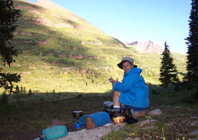
Here's our dining room in Fravert Basin with a panoramic view
across the valley!
|
|

