The
Travelogues of Diane and Dave
|
The
Travelogues of Diane and Dave
|
|||
|
|
Chapter 1: Backpacking in the Beartooth Wilderness, Part 1 |
|
|
|
|
||||||||||||||
|
|
||||||||||||||
|
|
|
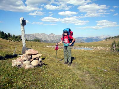
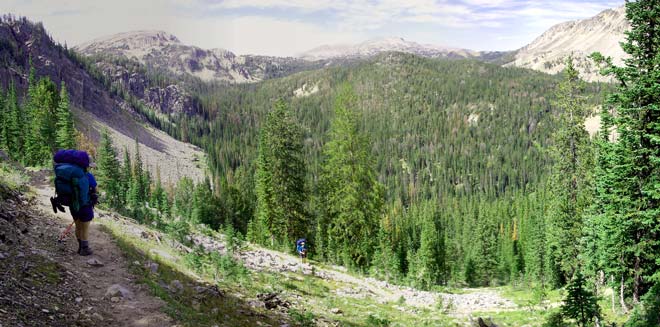
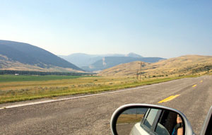
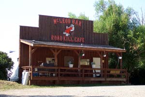
Day 1) Sat, Drive from Bozeman to Box Canyon Trailhead, Hike to Lake Kathleen Our first day in Bozeman and we had several things to do before we could start our drive to the trailhead. First, I had to unpack my luggage and load up my backpack. Second, we had to find the local outdoorsy store to get a Gaz canister and a lighter for the stove, both of which are items we can't take on the plane. We also bought some additional trail snack food. Then it was a 61 mile drive along the interstate to Big Timber where we got off at the exit and headed south down Rte 298 into Box Canyon following the Boulder River. It was 48 miles from the interstate to the end of the road at Box Canyon trailhead. At first the road meandered down the wide, open valley. Slowly the valley got narrower, the road got rougher, and the terrain got more forested. Along the way we passed by the McLeod Bar and Roadkill Café. We kept the place in mind for lunch on the way back out.
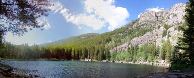
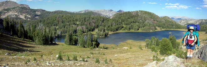
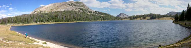
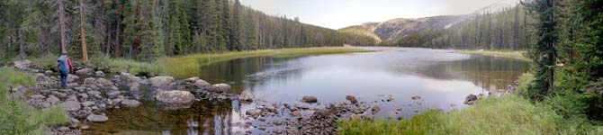
Day 2) Sun, Backpack from Lake Kathleen to Lake Pentad Our morning peace and quiet was disrupted by a lot of loud crashing noises outside. It sounded like a elephant was running around smashing thru the bushes all around us. We were too afraid to look outside. After it was quiet for some time, we went out and looked around. We didn't see anything except a peaceful large deer or elk grazing on a hillside behind the tent. It glanced at us and calmly trotted off over the hill. That was it. What ever had made all the noise earlier had thankfully left. We left Lake Kathleen and followed the trail to the southwest for Lake Columbine. The grade was more gradual, easy, uphill. We stopped at the lovely lake for a long lunch break. Across the lake we could see the hillside we were gonna have to hike up to get to Columbine Pass. This was our first real uphill climb. When we reached Columbine Pass, we had great views to the north of Favonius Lake. From there it was a short gentle descent down to Pentad Lake where we camped for the evening. There were several other people camped at the lake that evening. We could see the glow of their campfires at night.
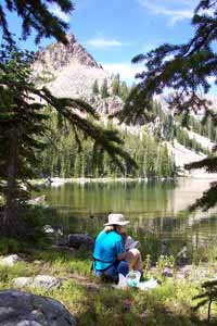
Lake Columbine from our lunch stop.
Columbine Pass looking to the North-East
Here we are approaching Favonius Lake. Pentad Lake is barely visible thru the trees to the left.
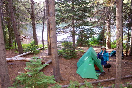
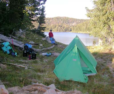
Our campsite at Lake Pentad. Day 3) Mon, Backpack to Lake Pinchot Again in the morning, I heard something moving around outside the tent, but the warmth and comfort of my sleeping bag was greater than my curiosity. When we finally got up and out it was another beautiful day. We followed the trail down a gentle descent to Jordan Lake. It was small lake similar to Lake Kathleen. It was nestled up against a steep rocky slope. The far side was an open forested area with large camp areas that appeared to be heavily used.
Here we are leaving Pentad Lake. The trail follows the righthand shoreline to Jordan Lake.
Here we are descending Jordan Pass. I was very happy we didn't have to climb these switchbacks.
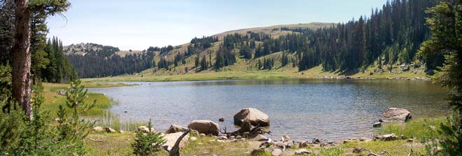
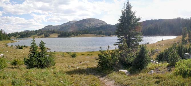
Diane walking along the shores of Wounded Man Lake heading for Pinchot Lake to the left.
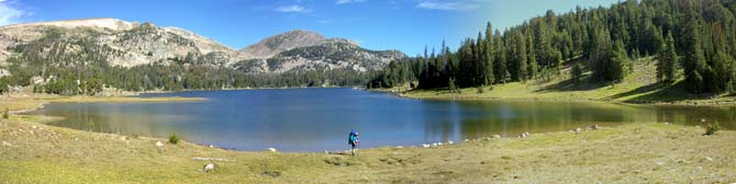
Arriving at Lake Pinchot. Day 4) Tues, Dayhike to Lake Surrender Today we woke up to an overcast sky and snow flurries. We were planning on doing a day hike from Lake Pinchot. According to the map, there's a stream valley leading down from Lake Pinchot past several remote lakes. Our guide book also mentioned it as a good bushwhack route. So, we buttoned up the tent, put on our warmest clothes, and headed of to the outlet of Pinchot Lake to find the stream valley. We found the lake outlet easily and started bushwhacking down the valley following the stream. The going wasn't easy till "Lo and Behold!" we found an old trail that was leading the way we wanted to go! The trail was not on any map we had, but we decided to follow it. It sure made the going a whole lot easier. We soon came to the first remote lake, "Dreary Lake". It was hard to get a good vantage point to see the whole lake.
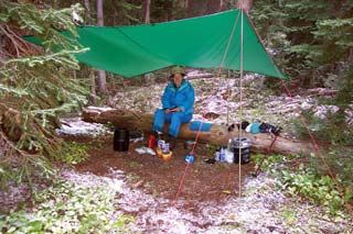
The west end of Lake Cimmerian. We eventually made it back to our campsite, following the trail the whole way. By backtracking on the trail, we found out where it originated at Lake Pinchot. When we got back to camp, the whole tent was frosted from the snow showers. I was glad I had left up the dining fly, because it meant that we had a dry place to eat our well deserved supper that night. We were so glad that we had found that old unofficial trail. It had made the day's hike so much easier. If it hadn't existed or if we hadn't found it, we would never have been able to cover the distance we had, a total of about 7.4 miles.
|
||||||||||||
|
|
||||||||||||||
|
|
|
|
last revised
:
February 8, 2006
|
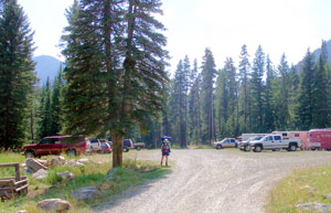 Box Canyon Trailhead parking lot.