The Travelogues of Diane and Dave
Travelogue Index
D & D Home
Links
Disclaimer


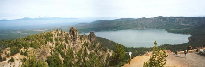
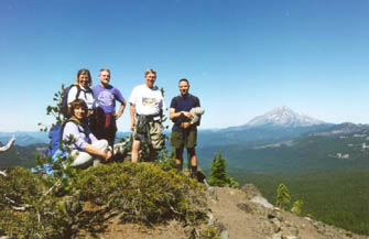
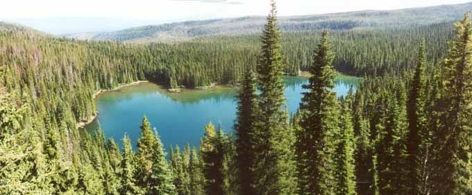
It was the Fall of 2002 and we still had a week of vacation to "use or lose". There was no way we were going to "lose" it so when the opportunity to go on a hiking trip out near the Three Sisters Wilderness area came along, we decided to grab it. That's how we found ourselves going to Bend, Oregon with 9 other friends from our local hiking club (Center Hiking Club). The trip was already planned and all we had to do was follow the leaders, Duncan and Nora. We used our frequent flyer miles from Northwest Airlines and made our hotel reservations at the Bend Riverside Motel. Since we didn't do any of the planning for the trip, we didn't have any maps or info on the area. Therefore, the following trip narrative may be a bit sketchy at times and some of the landmarks are unnamed.

DAY 1 - The first day of hiking was at the Newberry National Volcanic Monument. We car-pooled to the top of Paulina Peak (7985 ft elev.). From there we got a great view of Paulina Lake (see photo below).

Paulina Lake from Paulina Peak

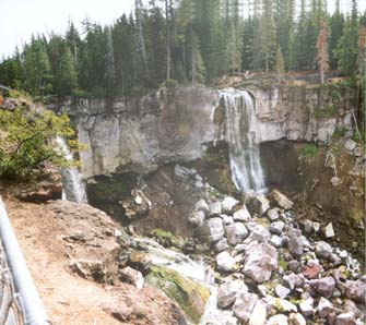
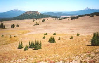
From Paulina Peak we hiked down to Paulina Lake where we picked up Paulina Creek and followed it downstream. Along the way, we passed by the lovely Paulina Falls. Due to the draught conditions that year, the trail was VERY dry and dusty.

Paulina Falls
View along Paulina Creek

The 80 ft Paulina Falls. There are two falls, the one to the left is just visible behind the green bush.

The trail follows Paulina Creek through an area that had been ravaged by a forest fire.


DAY 2 - Today we hiked around Three Fingered Jack (7841 ft elev.). It was our favorite hike of the trip. The trail took us up to the base of Three Fingered Jack where we ate our lunch in the shadow of the peak. Looking up at the surrounding ridge we could see a stretch of the Pacific Crest Trail (PCT) and a small knob called Porcupine Peak. We bush-wacked our way up the side of the ridge to the PCT where we made our way to Porcupine Peak.

Below is a group shot of the 6 of us that made it to the top of Porcupine Peak. (I'm behind the camera). Behind us in the far distance is Mt. Jefferson (10,495 ft elev.)

Below that is a 360 degree panoramic shot of the view from the top.

The approach to Three Fingered Jack
On top of Porcupine Peak

The group on Porcupine Peak.

Here we are hiking to the base of Three Fingered Jack

Porcupine Peak panorama
A 360 degree panoramic view from the top of Porcupine Peak. Click on the photo for a larger version (155k)


W? Lake

On the way back to the trailhead from Porcupine Peak, we passed by Wasco Lake. The trail descended from here down to the shoreline where there were several nice shorefront campsites.


DAY 3 - We played tourists on this day, driving a few hours south of Bend to Crater Lake National Park. The drive to Crater Lake is long and boring. There isn't much along the way in terms of civilization.

Just as we approach Crater Lake we pass thru a pumice desert (shown to the right), the remains of an eruption several thousand years ago.

Below is a panoramic shot of the lake. You can click on the lake photo for a larger version of the photo (91k).


Pumice desert at Crater Lake

Crater Lake panorama

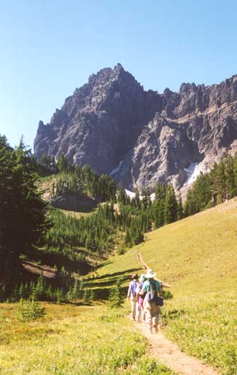
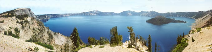
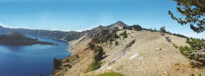
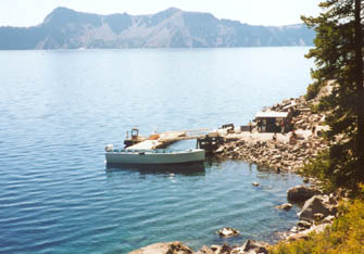
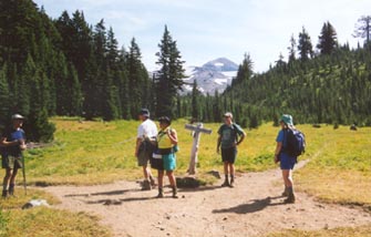
We were planning to take the boat ride on the lake, but due to the schedule, we had about 2 hrs to wait so we did a quick short hike along a section of the rim and stopped for a picnic lunch along the way. Below is a shot of us all hiking along the rim trail.

Hiking along Crater Lake rim


To take the boat ride you buy your ticket at a booth up on the rim. Then it's a 1 mile hike down to the lake shore 700 feet below. The boat ride is about 1-3/4 hrs long and takes you all around the lake and will even drop you off at Wizard Island if you want. A National Park Service Ranger describes the sights along the way. The boats are open topped so you better bring some form of sun protection.

To the right is a shot of the boat dock and tour boat. The tour boat carries about 35 or more passengers at one time.

Crater Lake boat ride


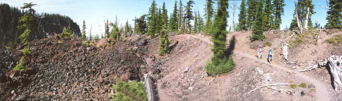
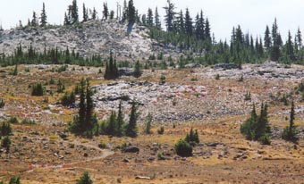
Day 4 - Today we hiked the Obsidian Flow Trail. This trail required a special permit from the Forest Service since they were trying to limit the usage of the area. The trail starts out meandering amongst a forest of tall pines. It then suddenly breaks out into the open when you walk into a 30 foot high wall of lava flow. The trail climbs the side of the lava flow and wanders around till it finds its way down the other side. The trail then looped around an area of open forest and meadows till you found your way back to the lava flow. The forest floor of the entire loop area was littered with obsidian. Obsidian is a form of lava that is like black glass. The surface is smooth and shiny. The ground literally sparkled from the sun glinting off all the obsidian. (It was like a parking lot filled with broken glass).

Hiking over the lava flow
Here's Nora and Diane hiking over the lava flow area.
A meadow on the Obsidian Flow Trail

Here's one of several of the meadow areas on the other side of the lava flow.

Fields of shining Obsidian
Waiting at the junction

The ground glittered and sparkled from all the
shards of Obsidian scattered about. The light colored rocky areas are really black, but appear white in the photo from the glinting sun.

While on the loop, we came to this junction. Everyone mills about while waiting for the "tail-draggers".


Travelogue Index
D & D Home
Links
Disclaimer
last revised : February 12, 2006