The Travelogues of Diane and Dave
Travelogue Index
D & D Home
Links
Disclaimer


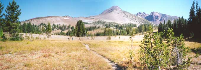
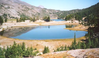
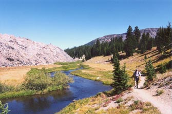
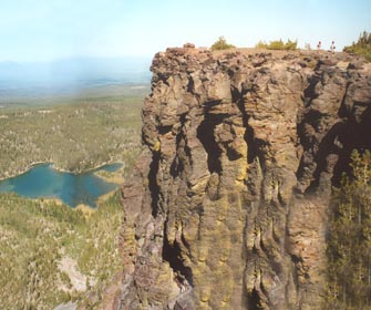
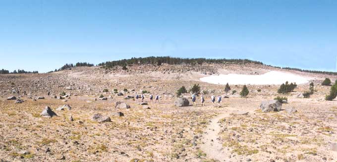
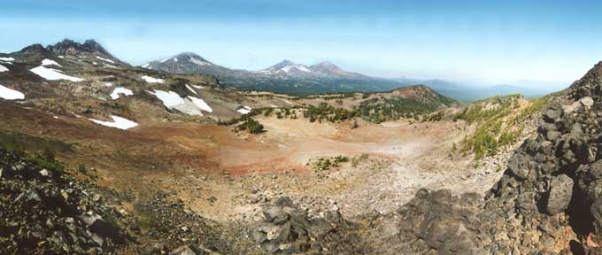
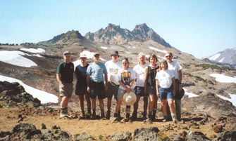
Day 5 - Today we hiked up to Green Lakes which is near Mt Bachelor and Broken Top.

Along the trail to Green Lakes

The long trail to Green Lakes. Up ahead is South Sister Mt. on the left and Broken Top Mt. on the right.

Green Lakes
The trail back to Green Lakes Trailhead

Up ahead are the Green Lakes.

The route back to the trailhead. The mound to the left is an old lava flow rich in Obsidian.

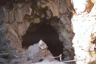
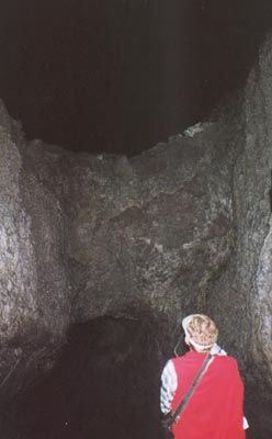
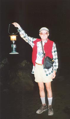
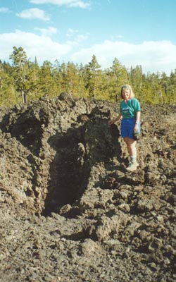
We had lunch in the shade under some trees along the shores of the lake. After lunch, several of us wanted to check out the lava river cave and lava cast forest just south of Bend so we broke off from the group to head back to the cars early. The rest of the group continued on beyond the Green Lakes.

The lava river cave was a mile long cave created by a lava flow that had hardened on the outside and then the inside flowed out leaving a hollow tube. The lava cast forest was an area where a lava flow had run thru a forested area and coated the trees with molten lava and then cooled. Over the years the enclosed trees had rotted and decayed away leaving an empty cast or mold of the tree that had once existed there.

The first destination was the lava river cave and then the Lava Cast Forest.

Lava river cave entrance

<-- To the left is the entrance to the lava river cave. The ceiling had caved in centuries ago exposing the cave. A series of stairs led you down into the cave.

Below left is a shot in the cave. At several points in the cave there was a "false" ceiling where there was an upper chamber and lower chamber. The two chambers eventually came back together.

Below right is me exploring the cave. At the ticket booth they rented lanterns which were well worth the added expense since none of us had very good flashlights.

Double-decker cave
Me exploring the cave

Here's Diane standing next to one of the lava casts in the Lava Cast Forest. You can see that the lava flow came in from behind Diane and piled up when it hit the tree. You can just make out the vertical cylindrical hole or mold of where the tree stood. The tree had been about 2 feet in diameter.

The drive out to the Lava Cast Forest was a long rough dirt road. In retrospect, the scenery was probably not worth the drive.

Diane at Lava Cast Forest


Day 6 - Tam McArthur Ridge was today's destination. The trail started as a moderate climb to the top of the ridge. Then the trail leveled out as it followed the rolling terrain of the ridge line. The views out to the sides were fabulous. We stopped at one rocky promontory (photo to the right) for a brief rest and snack. The lake below is Little Three Creek Lake. We then continued on hiking to our lunch break.

Shortly after lunch, the group broke up again, with three of us returning early to do some sightseeing back in Bend. The rest continued on along the ridge until the trail ended when it ran into Broken Top and the route became impassible.

Rocky promontory for snack time
 
A section of the trail along the ridge

Here's the group hiking along a section of the trail along the ridge.

Our view at lunch
This is the view we enjoyed while eating lunch. Directly below us is a large bowl area. The mountains in the distance are: (from left to right) Broken Top, South Sister, Middle Sister, and North Sister.
The group at lunch on Tam McArthur Ridge

Here's the group of us on Tam McArthur Ridge. This was our lunch spot.
The mountain behind us is called Broken Top.
(Click on photo for larger version, 44k)

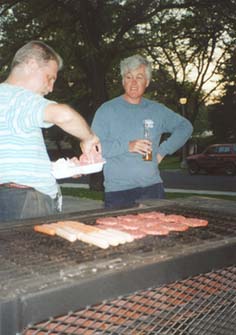
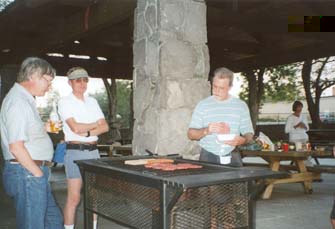
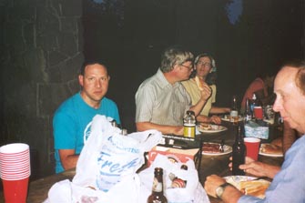
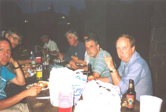
That evening, instead of going out to supper at a restaurant, Jim (Center Hiking Club president) suggested we have a picnic There was a pavilion in the river-side park next to the motel that had picnic tables and grills. Jim volunteered to get all the ingredients and cook all the burgers and hot-dogs. All everyone else had to do was show up and eat, and eat we did! Below are some shots of our picnic.

Rick keeps an eye on Jim as he cooks.
Duncan and I watch over Jim's cooking.
The picnic
The picnic

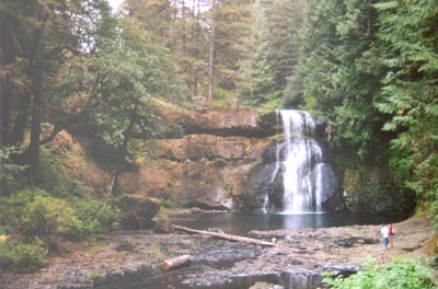
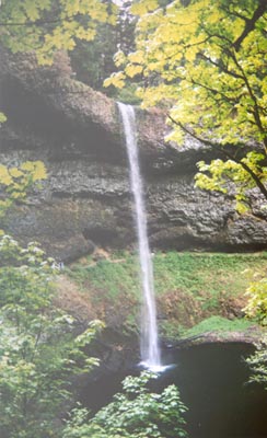
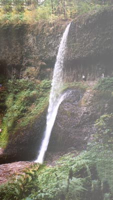
Day 7 - This morning we checked out of the hotel and started driving back to Portland for evening flights back home. Along the way we stopped off at Silver Falls State Park for one more hike. Silver Falls State Park is a beautiful state park with two main creeks and ten magnificent waterfalls. The most spectacular and tallest falls is South Falls at 177 ft. The 8.7 mile "Trail of Ten Falls" winds thru a canyon following the North Fork and South Fork of Silver Creek. The canyon was very lush and green. The trail goes past all of the ten falls. The three photos below show you three of the 10 falls. As you can see from 2 of the photos, in many cases the trail takes you behind the falls for a different point of view.

To the right is Upper North Falls with a 65 ft drop.


Below right is Lower South Falls with a 93 ft drop


Below left is South Falls with a 177 foot drop.

Upper North Falls, 65 ft
South Falls, 177 ft
Lower South Falls, 93 ft

After our hike thru the park, we piled back into our cars and drove back to downtown Portland. There, the group spilt up, some going to the airport, some to eat out, and others off to local motels for they were staying some additional nights.

And thus ended our Oregonian adventures.


Travelogue Index
D & D Home
Links
Disclaimer
last revised : February 12, 2006